



SYNTHESIS Informat.ro / Why was the flood at the Nepal-Tibet border so powerful? Experts' explanations


Always see our news on Google
A landslide of ice, rock, and sediment seems to have triggered the chain of events that transformed, in a matter of minutes, the rivers in northern Nepal into a devastating torrent. Preliminary data indicate a cascading catastrophe, occurring in a region where the steep terrain, the fragility of the mountain environment, and the built infrastructure in the valleys amplify the effects of such phenomena. Experts are also analyzing to what extent climate change has contributed to the instability of the glacier and the slopes.
A flash flood that occurred Wednesday in the mountainous border area between Nepal and Tibet has caused one of the most severe recent disasters in the Himalayas. The toll is continuously changing: the Nepalese police have reported at least 332 deaths in Nepal, while over 900 people are still missing; Chinese authorities separately reported three deaths and 558 missing in the Gyirong district of Tibet. The figures cannot simply be added together, as it is unclear whether some individuals have been reported in both record-keeping systems.
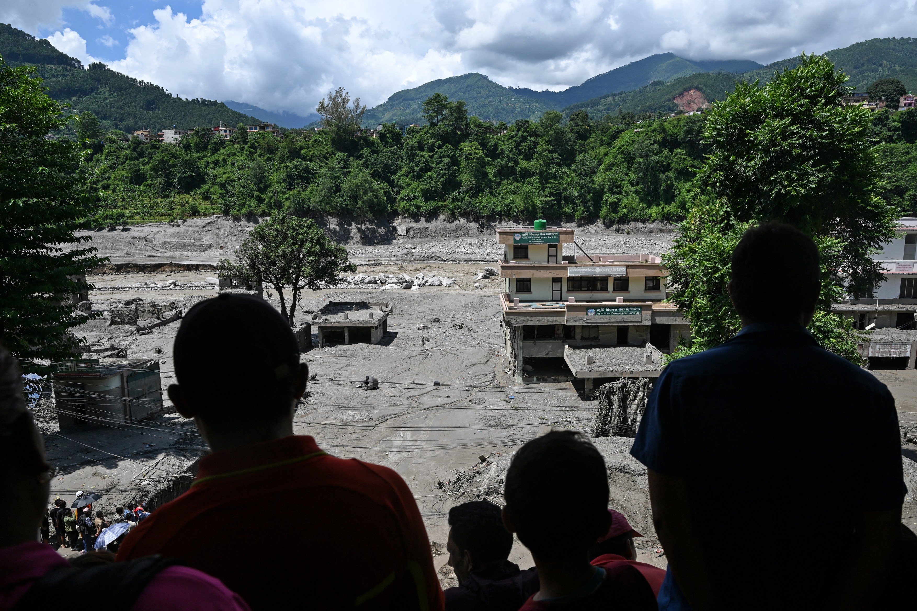
PHOTO: SWNS / SWNS / Profimedia
Initial assessments by geologists, corroborated with satellite images, indicate that the flood may have been triggered by the detachment of a portion from the lower part of a glacier. The mass of ice, along with rock and sediment, is believed to have collapsed from the slope into the valley, carrying water, mud, and boulders. According to preliminary assessments, this mixture generated an extremely powerful torrent that propagated down the Lhende river valley, overflowing into the Bhote Koshi basin and further into the Trishuli hydrographic system. The exact cause of the glacier's detachment has not yet been established.
Not a simple flood
The flood does not appear to have been caused by ordinary torrential rains. According to the US Geological Survey, the initial seismic signal interpreted as a magnitude 5.2 earthquake was, in fact, the energy produced by the glacial collapse and the subsequent flow of debris. In other words, this glacier detachment was the source of the seismic signal, not the consequence of an earthquake.
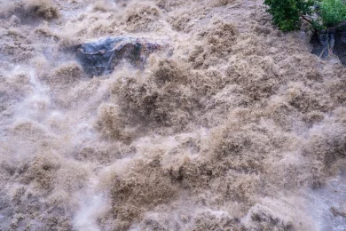
This is an essential distinction. In the case of a classic flood, water accumulates gradually following precipitation or snowmelt. Here, a massive mass of ice and rock fell from a great height, instantly transferring energy down the valley and pushing a dense mixture of water, sediment, and boulders. Such a flow has an impact force incomparably greater than that of water merely exceeding the normal river level.
Specialist Dan Shugar, a professor at the University of Calgary, estimated based on Planet Labs images that the lower part of the glacier detached from about 5,200 meters altitude and fell approximately 1,200 meters to the valley floor. Comparative images before and after the disaster show a slope that was green and has become covered with dark-colored sediment. How the force was amplified
In the steep terrains of the Himalayas, gravity acts as an accelerator. Material detached from altitude descends steep slopes, and its energy increases by dragging other rocks, ice, snow, and water along the way. As the mass reaches the narrow bed of a mountain river, the valley can channel and concentrate the torrent, increasing its speed and destructive power.
ICIMOD, the international research center for the Hindu Kush–Himalaya region, reported that the wave of water, sediment, and boulders crossed the Bhote Koshi and Trishuli basins. In the town of Galchhi, located downstream, the river level reportedly rose by up to nine meters in just 30 minutes.
Verified video images from BBC show a violent increase in water in a populated valley on the Trishuli river: buildings and land that were visible at the beginning of the filming were covered by water in about three minutes. This sequence illustrates why evacuation can become almost impossible in a glacial flood: the time available for response is sometimes measured in minutes, not hours. Possible dam effect
Another hypothesis analyzed by authorities and experts is that the avalanche of ice, rock, and sediment may have temporarily blocked the course of a narrow river. In such a situation, water accumulates upstream, behind a natural dam formed by debris, and its failure can suddenly release a large volume of water, mud, and boulders. Such a wave can cause destruction over significant distances downstream, affecting bridges, roads, homes, and energy infrastructure. In the Gyirong area, on the Tibetan side of the border, authorities are monitoring a dam lake formed upstream of the disaster area. Its existence maintains the risk of new floods if the accumulation of sediment obstructing the riverbed becomes unstable or fails.
Basanta Raj Adhikari, director of the Disaster Studies Center at Tribhuvan University in Nepal, spoke about the risk of "second and third waves," even in the absence of heavy rains, as landslides and debris dams can continue to abruptly change the river regimes.
Climate: risk factor, not verdict
A direct and exclusive contribution of climate change to the collapse this week cannot yet be established. Such a conclusion requires detailed analysis of temperatures, precipitation, glacier structure, permafrost, and slope stability. Researchers cited by Reuters and BBC urge caution: there is credible evidence of a role for high temperatures and accelerated melting, but there is not yet a definitive scientific attribution for this specific collapse.
However, the regional context is alarming. Reuters notes, citing UN data from 2023, that the mountains of Nepal have lost nearly a third of their ice in just over three decades, and the rate of glacier melting has been 65% faster in the last decade than in the previous one.
Warming can weaken slopes in several ways. Melting snow and ice adds water to cracks; thawing permafrost reduces the natural "cement" that binds fractured rock; and retreating glaciers lose the ability to support some portions of the slope. In the 24 hours before the disaster, satellite images analyzed by Dan Shugar suggested rapid melting of snow in the area, consistent with a warm weather episode. An exposed area
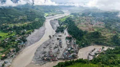
The Rasuwa district, in northern Nepal, on the border with Tibet, is among the areas affected by the flood. The region includes popular trekking routes, including the Langtang trekking area, as well as the route used by pilgrims to Kailash Mansarovar, in Tibet.
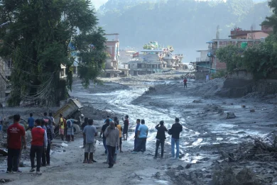
 Flood in Rasuwa / PHOTO: SWNS / SWNS / Profimedia
In the valleys of Rasuwa, vulnerable infrastructure to floods is concentrated: roads, bridges, border crossing points, and hydroelectric projects. These elements explain why the effects of the disaster have exceeded local communities, also affecting cross-border traffic, tourism, and energy production.
This overlap between a dangerous terrain and human activity explains the severity of the toll. The flood hit not only villages but also roads, bridges, logistics points, energy infrastructure, and areas frequented by tourists and pilgrims. Rescue teams face difficult access, with many sectors in northern Nepal being reachable only by helicopter after the destruction of roads and bridges.
The tragedy also brings attention back to the history of the Langtang area. In 2015, an earthquake in Nepal triggered a massive avalanche of ice, snow, and rock that destroyed the village of Langtang and caused at least 215 deaths. The current event seems to have originated from the Langtang Lirung massif as well, but from the northern slope, not the southern slope involved in the 2015 disaster.
At this stage, the most rigorous conclusion is that the flood was the product of a chain of phenomena: glacial collapse, rock and ice avalanche, sediment and water flow, possible temporary blockage of valleys, and the propagation of a devastating flow downstream. Climate change may be a factor that has increased the vulnerability of the slopes, but the precise mechanism and the weight of each cause can only be established after ongoing geological and hydrological investigations.
*****Synthesis made with the help of a data monitoring flow provided by the media monitoring platform NewsVibe Romania. The analysis, data, and images presented have been enhanced with the help of Machine Learning and Artificial Intelligence tools.
Latest News
17:35
17:30
17:24
17:07
17:00
See more news
NEWS ON THE SAME TOPICS





















.webp)


