



The EU is mobilizing emergency aid and Copernicus after the earthquake in Colombia



Always see our news on Google
The European Commission has reallocated 100,000 euros for initial interventions in the Chocó region and activated the Copernicus service for mapping the affected areas. Colombia has also requested support through the EU Civil Protection Mechanism, and the need for additional assistance is currently being assessed.
The European Union has mobilized the first support measures for Colombia after the earthquake, reallocating 100,000 euros for immediate assistance in the Chocó region and activating the Copernicus satellite service for mapping the disaster effects. Colombian authorities have also activated the EU Civil Protection Mechanism, which allows for the coordination of additional European support based on the needs identified on the ground.
In brief
The Commission has reallocated 100,000 euros for the first assistance provided to those affected in the Chocó region, through the German Red Cross, which is already present on the ground.
The Copernicus service has been activated for mapping the affected areas and providing information that can assist Colombian authorities in assessing the scale of the disaster.
Colombia has activated the EU Civil Protection Mechanism, through which it can request additional assistance from participating states.
The Commission is in contact with Colombian authorities to establish the concrete needs and the type of support that could be mobilized in the next stage.
The 100,000 euros represent the initial aid announced by the Commission and not the total value of any potential European support for the earthquake response.
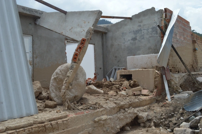
The European Commission has begun to mobilize support for authorities and the population in Colombia after the earthquake that caused casualties, injuries, and destruction.
The first financial intervention announced is 100,000 euros. The funds have been reallocated for immediate assistance to those affected in the Chocó region and will be used through the German Red Cross, one of the humanitarian partners already on the ground.
The Commission described the amount as rapid aid for the first stage of the response. It does not represent a final support package and may be followed by other measures after assessing the extent of the damages and the needs of the population.
In parallel, the Union has activated the Copernicus service for emergency mapping. The system uses satellite images and data to create maps of areas affected by disasters.
This information can help authorities identify the affected areas, compare the situation after the earthquake with existing data, and organize interventions based on the available information.
Copernicus does not represent a European intervention team and does not conduct rescue operations. Its role is to provide rapid geospatial information for authorities coordinating the response.
The President of the European Commission announced the activation of the service after the earthquake occurred, and the High Representative of the EU expressed condolences to the Colombian authorities and affected individuals.
The Commission later confirmed at a briefing that the service had already been mobilized and that its data could be used to assess the extent of the disaster and support Colombian authorities.
A third component of the response is the EU Civil Protection Mechanism. According to the Commission, Colombian authorities have activated the mechanism and are in contact with Brussels regarding the necessary support.
Activating the mechanism allows a state affected by a disaster to request specific types of assistance, and the Commission coordinates the offers that can be made by participating states.
Assistance may vary depending on the nature of the disaster and the requests of the affected country. The types of support have not yet been specified for Colombia at the time of the briefing.
The Commission stated that it needs a more complete picture of the earthquake's scale, the damages, and the existing needs before specifying the next measures.
Therefore, activating the mechanism does not mean that all member states have already sent teams or equipment to Colombia. It opens the procedure through which needs can be communicated and assistance offers coordinated.
The support of 100,000 euros is separate from this procedure. It has been reallocated so that the humanitarian partner already on the ground can provide immediate assistance without waiting for the completion of the necessary assessment for a larger operation.
The Chocó region has been identified by the Commission as the area to which this initial funding is directed.
The Commission did not provide a breakdown at the briefing of how the 100,000 euros will be spent or the number of people who will benefit from the aid.
No estimate of the total value of the damages caused by the earthquake or the European budget that could be mobilized later was presented.
These values depend on the assessments made by Colombian authorities, organizations on the ground, and European structures involved in coordinating the response.
The combination of initial humanitarian funding, Copernicus mapping, and the activation of the European mechanism allows for different interventions at the same stage of the response.
Funding can be used for the immediate needs of the population, while satellite information can support operational planning. The Civil Protection Mechanism can be used if authorities later request equipment, expertise, or other forms of assistance.
The Commission specified that it is in contact with Colombian authorities and that European support will be adapted after clarifying the existing needs.
This process means that the scale of the EU intervention may increase after the initial assessments.
The EU Civil Protection Mechanism allows for the coordination of support provided in cases of disasters that exceed a country's response capacity. It can also be activated by states outside the European Union.
The Commission coordinates the response after receiving a request and centralizes the available assistance offers from participating states.
Copernicus complements this mechanism with information obtained from satellites and other geospatial sources. Emergency mapping is used for natural disasters and other situations where authorities need a rapid picture of the affected areas.
In the case of Colombia, the measures announced at the briefing on August 11 represent the first stage of the European response. The Commission has not yet announced the size of any potential additional package or the types of assistance that will be offered through the Civil Protection Mechanism.
Latest News
15:22
15:22
15:12
15:10
15:02
See more news
NEWS ON THE SAME TOPICS










.webp)