



On Saturday and Monday, rain and snow will affect most of the country, with significant water accumulation and strong winds.
Lara Maior



Environment
Ananthu143y/ Shutterstock.com

Always see our news on Google
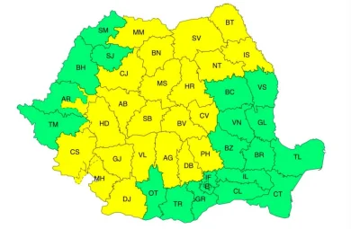
From Saturday, 10 AM, until Monday, 10 AM, Romania will be affected by rain in most regions. Especially in the north of Oltenia, the northwest of Muntenia, and the west of the Southern Carpathians, water amounts of 20-30 l/m² will accumulate, and isolated areas may exceed 40 l/m². Starting from Saturday night, in the Western Plain, Transylvania, and the northwest of Moldavia, the precipitation will include sleet and snow, with the risk of ice formation. In the mountains, snow will prevail, and snow will accumulate on the peaks. The wind will intensify, reaching speeds of 45-50 km/h in the southeast and gusts of over 80-90 km/h in the mountainous area of the Southern Carpathians. The weather will cool significantly, and from Sunday to Monday, negative minimum temperatures will be recorded in the western half of the country. Meteorologists have issued a yellow code for severe weather, valid from Saturday, 10 AM, until Sunday, 10 AM, for the counties of Gorj, Vâlcea, Argeș, Hunedoara, Alba, and Sibiu, where the precipitation will turn into sleet and snow.
Sources


Latest News
22:57
Prosecutor seeks sentences of up to 12 years for three doctors accused in the death of Diego Maradona
22:53
Donald Trump calls those who use the term “artificial intelligence” instead of “Super Intelligence” “enemies”
22:42
A bison weighing over 800 kilograms was found dead and decapitated in Măgura Ilvei. The police are investigating the case
22:30
George Simion, comment on Luca Niculescu's post about negotiations with the parties: “So, will you be the prime minister in the PSD government?”
22:28
Trump promises that the US will not resume attacks before the midterm elections
See more news
NEWS ON THE SAME TOPICS

Current Affairs
Meteorologists announce strong winds in 13 counties and a significant cooling, with rain and snowfall in the mountains until Thursday

Current Affairs
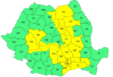
Bad weather warnings. Over half of the country will be under a yellow code for atmospheric instability and strong winds.
Current Affairs
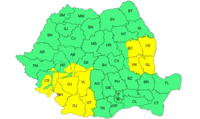
ANM: Yellow code for severe weather in Muntenia and other regions of the country / Torrential rains and gusts of wind up to 70 km/h
.webp)

Personalized news feed, AI-powered search, and notifications in a more interactive experience.