


Satellites can detect environmental crimes, but images do not automatically become evidence in court



Always see our news on Google
A report prepared by Istituto Affari Internazionali for the European Space Agency inventories the use of Earth observation against illegal deforestation, pollution, illegal fishing, and illegal mining. Ten case studies show operational uses, including in Flanders and Lombardy, while the authors identify legal, institutional, and skills-related obstacles that may prevent satellite imagery from being transformed into usable evidence by investigators and courts.
Satellite imagery is already used to identify deforestation, pollution, illegal fishing, mining operations, and clandestine waste dumps, but moving from detecting an anomaly on a map to usable evidence in a criminal case remains difficult, according to a 212-page report published by Istituto Affari Internazionali. The research, carried out as part of a project commissioned by the European Space Agency, examines for the first time within a single framework the users and types of use of Earth observation against environmental crimes worldwide.
The report does not attempt to calculate a European conviction rate resulting from satellite imagery, nor does it claim that such imagery can replace traditional investigations. The authors treat it as a tool that can locate suspicious activities, reconstruct changes occurring over time, prioritize inspections, and complement other sources of information, while the procedural value of the material depends on the legislation, methods, and capacity of the institutions using it.
In brief
1. The report is 212 pages long and combines desk research, more than 38 interviews, and ten case studies selected for their usefulness and replicability.
2. The main areas analyzed are illegal deforestation, pollution, fisheries-related crimes, and illegal mining, alongside other environmental activities.
3. The European case studies include remote monitoring for enforcing environmental policies in Flanders, the use of data by the European Fisheries Control Agency, and AI-based detection of illegal dumps in northern Italy.
4. The authors identify barriers related to institutional organization, technical knowledge, data access, and the legal use of information in investigations and proceedings.
5. The European directive on environmental crime requires states to have effective investigative tools, but does not mandate the use of satellite imagery and does not automatically harmonize national rules on evidence.
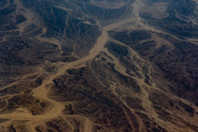
A major advantage of Earth observation is its ability to compare an area before and after a suspicious activity. Successive images can show the disappearance of vegetation, the expansion of an excavation, the emergence of dumps, or changes in water and soil, providing authorities with a timeline that can be difficult to obtain solely through field inspections. In hard-to-reach areas, this perspective can make it possible to focus resources on locations with the highest likelihood of law violations.
The report presents ten international examples selected for their impact and replicability. In Flanders, remote sensing is used to support the enforcement of environmental policies, while another study examines the activities of the European Fisheries Control Agency against violations in the fishing sector. In Lombardy and other areas of northern Italy, analysis combined with artificial intelligence is used to detect illegal dumps and solid waste.
The fact that an image identifies a change does not by itself indicate who caused it, whether the activity was authorized, or whether all the elements of a crime are present. Therefore, the authors present satellite data as one component of an investigation, which must be combined with administrative information, inspections, documents, statements, and other evidence to establish responsibility.
Another barrier is the wide disparity between institutions in terms of technical capacity. Some authorities already use platforms and specialized staff to analyze imagery, while others have no employees capable of selecting datasets, interpreting images, or explaining the results in a form intelligible to prosecutors and judges. The report thus identifies expertise and cooperation between technical and legal specialists as elements just as important as satellite availability.
The European framework for environmental crime makes the issue more relevant. Directive 2024/1203 expanded the list of offenses and requires Member States to make effective investigative tools available to authorities, comparable to those used for other serious forms of crime where this is appropriate and proportionate. However, the European text does not prescribe a particular technology and does not state that a Copernicus image or an image originating from another satellite automatically becomes admissible evidence.
The deadline for transposing the directive was 21 May 2026, and Eurojust has meanwhile published guidance for practitioners on the new criminal-law framework. How Earth observation actually enters a case file therefore continues to depend on criminal procedure, investigative structures, and technical capacity in each state.
Romania is not among the ten case studies examined in detail in the report. The document therefore does not provide a measurement of how frequently the Romanian police, prosecutors, or courts use satellite imagery in environmental cases, nor does it allow a conclusion about the effectiveness of these tools in the Romanian judicial system.
The report's conclusion is more general. Europe already has very large quantities of Earth observation data and advanced satellite infrastructure, but their value in combating environmental crime depends on transforming images into interpretable information, on institutions that know when to use it, and on legal procedures capable of integrating it alongside other evidence.
Sources

Latest News
12:54
12:51
12:45
12:38
12:36
See more news
NEWS ON THE SAME TOPICS










.webp)