


The new spatial course starts on your phone
Călin Nicolescu


IT&C knowledge
Foto 2eu.brussels

Always see our news on Google
Morning, before you read the first news, you have already used spatial infrastructure. Your phone has calculated your position. The car or transport application has suggested a route. A weather application has transformed data about the atmosphere, clouds, temperature, or precipitation into a forecast displayed in a few seconds. A banking transaction, a telecommunications network, or a digital service has depended on precise synchronization, invisible to the user.
Space is still associated with rockets, astronauts, exploration, spectacular images of Earth, and competition between great powers. The report published by the European Union Agency for the Space Programme shows a closer and more pragmatic reality: the space economy is increasingly moving into everyday services, into data, into applications, into connectivity, into security, and into the ability of states to respond to crises.
The new space race is about the signal that tells you where you are, the images that show how the climate is changing, the data that helps agriculture, the communications used by authorities in emergencies, and the digital services that transform satellites into economic infrastructure.
EUSPA published in Prague, on May 26, 2026, the new EU Space Market Report, presented as an analysis of the global downstream market, that is, the market where satellite data and signals become services for users, companies, and institutions. The report brings together, for the first time in a single publication, satellite navigation, Earth observation, secure satellite communications, and space situational awareness. This grouping shows that space services increasingly function as a common ecosystem, where data about position, images of Earth, secure communications, and monitoring of the orbital environment complement each other.
In technical language, the report talks about GNSS, Earth Observation, Secure SATCOM, and Space Situational Awareness. In everyday language, these fields mean localization, maps, precision agriculture, forecasts, disaster monitoring, government communications, emergency interventions, critical infrastructure protection, and monitoring the traffic of objects in orbit.
The European stakes have two dimensions. The first is economic: services built on space infrastructure are becoming a market worth hundreds of billions of euros. The second is strategic: states, companies, and citizens increasingly depend on systems that can be controlled, disrupted, competed with, or dominated by other global actors.
The EUSPA report puts the economic dimension into numbers. Global revenues from satellite navigation are estimated to grow from approximately 300 billion euros in 2024 to 580 billion euros in 2034. The global base of GNSS-compatible devices is expected to reach nearly 10 billion by 2034. The global Earth observation market is estimated to grow from 3.5 billion euros in 2024 to 7.9 billion euros in 2034, with agriculture having the largest share. In secure satellite communications, revenues from data services generated by European users are estimated to grow from over 200 million euros in 2025 to nearly 1.2 billion euros in 2040.
These figures tell a broader story than the growth of an industry. They show the shift of value from the satellite as a technological object to the services built on it. In the economy, those who transform the signal, image, position, and time into easy-to-use services win. In security, those who can guarantee the continuity of these services in times of crisis win. In global competition, those who can scale quickly, control infrastructure, and connect satellites to applications, platforms, and commercial services win.
Europe has two major advantages in this race. Galileo provides European positioning and synchronization services, with features such as open service, high-precision service, search and rescue, a regulated public service for authorized government users, and a future early warning service for natural or man-made disasters. Copernicus provides Earth observation data for the atmosphere, marine and terrestrial environments, climate, security, and emergency management, and its data is made available to users worldwide through a policy of complete, free, and open access.
These European programs have become high-value public infrastructures. A farmer can use data about soil and drought. A public authority can monitor a flood or a fire. An emergency service can receive better information about the terrain. A city can track environmental or infrastructure changes. A company can build commercial applications on open data. A government can use secure communications for sensitive missions.
This infrastructure is comfortable as long as it works. When it can be disrupted, blocked, delayed, or controlled by others, it becomes a vulnerability. That is why the EUSPA report must be read both as an economic document and as a political signal: space has become a basic infrastructure for European digital society.
Space in everyday life
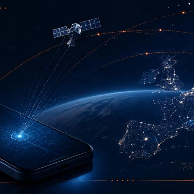
If the first image of the space race was the rocket, the image of the new space race is the phone screen. There, in a simplified form, a huge infrastructure of satellites, ground stations, algorithms, data centers, public services, and companies transforms invisible signals into usable information.
For the user, everything seems mundane. You tap on an app and see where you are. You receive a weather alert. You search for the fastest route. You order a car. You check if a package is approaching. You look at a map. Behind these ordinary gestures lies an infrastructure that the EUSPA report describes in technical terms: European satellite navigation systems allow compatible devices to determine position, speed, and time by processing signals transmitted by satellites.
This combination of position, speed, and time is one of the foundations of the digital world. Position tells you where you are. Speed allows tracking movement. Time synchronizes networks, transactions, infrastructures, and services that cannot function correctly if each system measures seconds differently.
In the case of Europe, this infrastructure has two main names: Galileo and EGNOS. Galileo provides positioning and timing information, including high-precision services, search and rescue, a regulated public service for authorized government users, and a future early warning service for natural or man-made disasters. EGNOS, the European Geostationary Navigation Overlay Service, enhances GPS signals and is being upgraded to include Galileo, focusing on applications where safety is critical.
Space provides more than just better maps. It provides trust in position and time. This trust becomes essential in transport, aviation, maritime navigation, agriculture, emergency interventions, digital services, and commercial applications that depend on location.
The phone is just the most visible gateway. A second European infrastructure, Copernicus, looks down on Earth and transforms it into data. The European Earth observation program uses Sentinel satellites, complementary public and commercial missions, and ground, sea, and atmospheric measurements. The data is processed into services for the atmosphere, marine and terrestrial environments, climate change, security, and emergency management.
When an administration monitors the evolution of a flood, it does not just see a beautiful satellite photograph. It sees a succession of data that can show which areas are affected, where intervention is possible, and how the situation is changing. When a farmer monitors drought, he can use data about soil, vegetation, temperature, or water stress. When an authority monitors air quality, coastal areas, energy, the Arctic environment, or heritage sites, Copernicus can provide specialized data through thematic hubs.
An essential element for the European model is that Copernicus data is available globally, completely, free, and open. This choice transforms the program into a global public infrastructure. It allows researchers, companies, authorities, and developers to build services based on European data. At the same time, openness creates an important commercial question: who succeeds in capturing the economic value of this data, European companies or global platforms with greater scaling power?
The third piece of the puzzle is secure connectivity. If Galileo and EGNOS tell where and when, and Copernicus shows what is happening on Earth, GOVSATCOM and IRIS² enter the area of communications used by authorities in situations where reliability, security, and resilience matter more than the comfort of the ordinary user.
GOVSATCOM is described by EUSPA as a program aimed at ensuring the long-term availability of reliable, secure, resilient, and cost-effective satellite communication services for European and national public authorities. The needs covered include emergency and security missions, defense-related operations, critical infrastructure, and diplomatic communications.
IRIS² takes this logic further. The EUSPA report presents it as the new component of secure satellite communications of the European Union Space Program, based on a multi-orbit constellation of 290 satellites, with assets in low and medium orbit, for secure and resilient connectivity. IRIS² aims to expand the GOVSATCOM portfolio and provide services for both authorized government users and commercial users.
The difference between these programs may seem technical. In reality, it describes a profound change. Europe is trying to build an infrastructure where data about position, images of Earth, and secure communications can work together. The phone, the map, the forecast, the emergency alert, environmental monitoring, infrastructure management, and government connectivity increasingly belong to the same technological ecosystem.
The EUSPA report formulates this change through the idea of synergy between GNSS, Earth observation, and secure satellite communications. Macrotendencies such as climate change, geopolitical instability, and rapid urbanization reshape space markets and increase the importance of these capabilities for security, resilience, disaster response, environmental monitoring, and urban and infrastructure management.
As these services become indispensable for cities, borders, transport, agriculture, energy, emergency interventions, and government communications, they become critical infrastructure. And critical infrastructure raises questions about control, security, dependence, competition, and Europe's ability to remain a relevant player in a global market increasingly dominated by technological speed and commercial scaling.
The new space race begins with a very close question: who provides you with the signal, data, and connection when you need them?
The new space race is commercial, technological, and geopolitical.
In the old space race, the dominant image was the launch. In the new space race, the dominant image is the service. Who can launch more often still matters. Who can build satellites cheaper matters enormously. The real advantage is seen when space infrastructure becomes a product, application, government contract, commercial subscription, military capability, risk map, or digital service used every day.
Current competition cannot be reduced to a comparison between public programs. The United States, China, and Europe compete through ecosystems: public funding, private companies, industrial chains, launch capacity, access to data, downstream services, commercial applications, and the link between space, security, and the digital economy.
The EUSPA report shows the European side of this transformation. The market is described through users, services, and revenues generated by applications. In the case of satellite navigation, EUSPA estimates that revenues from services will grow faster than revenues from devices, confirming the shift of value towards digital ecosystems built on space signals.
This shift is essential to understand the pressure on Europe. Galileo and Copernicus are high-performing public programs. They provide signal, data, trust, open access, and services that can support innovation. The global economy rewards actors who transform infrastructure into scalable, easily integrated, and easily sold products.
Here, the United States has a clear advantage: the strength of private companies. The American model has shifted an increasing part of the competition towards firms capable of rapidly reducing costs, launching frequently, developing large constellations, and selling services directly to governments, companies, and users. The Space Foundation estimated that the global space economy reached $613 billion in 2024, with the commercial sector accounting for 78% of the total. This figure changes the way the market should be read: space is increasingly dominated by commercial services that grow rapidly and attract users.
The United States also leads in launch rates. OECD data shows that, in 2022, the United States had 76 successful orbital launches, followed by China with 62 and Russia with 21. The OECD also notes the increasing number of countries developing launch capabilities, launcher projects, or spaceports, a sign that access to orbit is becoming a broader competition.
China represents another form of competition. It is a state-industrial competitor, with strategic planning, growing technological capacity, and the ambition to build its own infrastructures in navigation, Earth observation, communications, and exploration. For Europe, competition with China plays out in the ability to maintain technological control, industrial autonomy, and access to markets in a sector where the state and industry work closely together.
Europe is not a spectator. It has one of the strongest public space infrastructures in the world. Galileo provides positioning and timing services, Copernicus provides Earth observation data with complete, free, and open access, and the new components, GOVSATCOM and IRIS², extend the European program towards secure communications and resilient connectivity.
The difference is the pace. Europe excels at complex public programs, standards, open data, institutional cooperation, and public value infrastructures. The United States has a faster and more aggressively commercial private ecosystem. China has the ability to mobilize state and industrial resources in the long term. In this triangle, Europe must transform its public advantages into commercial, technological, and strategic capacity at a pace closer to the speed of the global market.
This tension is most clearly seen in the area of satellite communications. Starlink has changed market expectations through pace, coverage, and public visibility. Millions of people have begun to see satellite communications as a direct commercial product, not just as an abstract service for governments or isolated areas. This changes the competition. Europe competes with platforms that can reach users directly and can transform orbital infrastructure into a mass service.
IRIS² is the most visible European response to this pressure. EUSPA describes it as a multi-orbit constellation of 290 satellites, with assets in low and medium orbit, for secure and resilient connectivity. The program is expected to expand the GOVSATCOM portfolio and provide services for both authorized government users and commercial users.
The difference between Starlink and IRIS² is also a difference in model. Starlink represents the strength of a private actor that has rapidly built a global infrastructure and transformed it into a commercial service. IRIS² represents the European attempt to build a secure infrastructure, politically controlled, integrated into public objectives, and open to commercial services. For the citizen, the question seems simple: does the connection work or not? For states, the question is tougher: who controls the connection when a crisis arises?
The European Space Agency announced in November 2025 the largest contributions in its history, amounting to 22.3 billion euros, approved at the ESA Council at the ministerial level in Bremen. The decision shows that space is increasingly seen as an economic, technological, industrial, and security domain, at a time when global competition is accelerating.
In the 20th century, the space race was about who got there first. In the 21st century, the space race is about who delivers an indispensable service the fastest. Who has the signal. Who has the data. Who has the infrastructure. Who can maintain connectivity in a crisis. Who can transform Earth observations into products for agriculture, energy, transport, insurance, cities, and emergency interventions.
The commercial risk for Europe is that its public data and infrastructures create value that others monetize more efficiently. Copernicus data is open, and this openness is a democratic, scientific, and economic advantage. But in a global market dominated by platforms capable of scaling quickly, the final value may be captured by companies that have stronger distribution, capital, interfaces, and commercial relationships than many European firms.
The technological risk is that Europe remains excellent at public architectures but weaker at rapid execution, competitive costs, and global commercial services. The geopolitical risk is that everyday digital infrastructure, from navigation to secure communications, may depend in critical moments on actors outside European control. The industrial risk is that Europe produces standards, rules, and data while other ecosystems produce global champions that dominate the market.
This is the real tension behind the EUSPA figures. The market is growing. The need for space services is growing. The dependence of the public and states is growing. International competition is also growing. Europe has strong infrastructures, but it must transform this infrastructure into commercial, technological, and strategic capacity at a pace closer to the speed of the global market.
As space becomes critical infrastructure, vulnerability descends to Earth.
The more we depend on satellites, the less abstract the risks in space become. An orbital problem does not remain in orbit. It can affect navigation, communications, agriculture, transport, emergency interventions, financial services, energy infrastructure, defense, and the ability of states to function in crises.
This is one of the central changes of the new space economy. Space has become an infrastructure on which services that citizens consider normal depend. When this infrastructure is disrupted, the effect can appear on the phone, on the road, at the airport, in the port, in public networks, or in a command room where an emergency intervention is coordinated.
The European Union's strategy for security and defense in space starts from this reality. The European Commission and the High Representative presented in March 2023 a joint communication in which the EU aims to protect its space assets, defend its interests, deter hostile activities in space, and strengthen its strategic autonomy. The official document describes space as a domain increasingly marked by competition between powers and the intensification of threats.
The risks are not of a single type. Some are physical, such as collisions with space debris or with objects in orbit. Others are technological, such as jamming, spoofing, or attacks on the ground segment of space infrastructure. Others are geopolitical, as commercial or governmental infrastructures can become tools of pressure, dependence, or strategic advantage.
In the EUSPA report, this universe of risks appears through the component of Space Situational Awareness, that is, the monitoring and understanding of the space environment. SSA includes three areas: tracking and monitoring space objects, monitoring near-Earth objects, and services related to space weather. Europe needs to know what is moving above it, what could hit orbital infrastructure, and what solar phenomena could affect satellites or services that depend on them.
Space debris is the first risk easy to understand. If the orbit becomes too crowded, satellites must perform avoidance maneuvers, consume fuel, and may temporarily interrupt observations or shorten their lifespan. ESA shows in the Space Environment Report 2025 that the number of space debris continues to grow rapidly and that monitoring networks track approximately 40,000 objects, of which about 11,000 are active payloads.
This crowding changes the economic logic of space. A market that depends on thousands of satellites also needs rules, monitoring, coordination, and responsibility. A lost satellite is not just a technical loss for the operator. It can become a risk for other satellites, for climate data, for communications, for agricultural observations, or for services used by authorities.
The second risk is invisible to the user: signal disruption. Satellite navigation is useful precisely because it provides position and time. If the signal is jammed or spoofed, the problem can quickly become practical. A ship, an airplane, a truck, an energy infrastructure, or a timing system can receive incorrect information or may temporarily lose trust in position and time. For the citizen, the effect may seem like an application error. For authorities, it can be a safety issue.
The third risk is dependence on commercial infrastructures outside European control. Private companies can provide excellent, fast, and efficient services. In a crisis, however, the question changes. It does not just matter whether the service works well on an ordinary day. It matters who decides the conditions of access, price, priority, security, continuity, and availability of the service.
Here we see the link between IRIS² and international competition. IRIS² is an attempt to reduce European vulnerability in the area of secure communications. EUSPA describes the constellation as a multi-orbit system designed for secure and resilient connectivity, which will extend GOVSATCOM services to authorized government users and commercial users. In a market dominated by fast commercial actors, Europe is trying to build an infrastructure where security and public control are part of the architecture.
The fourth risk is regulatory fragmentation. If each member state has its own rules for space activities, operators face different requirements, and the internal market remains harder to integrate. The European Commission proposed on June 25, 2025, the EU Space Act, a harmonized framework for space activities in the Union, with objectives of safety, resilience, environmental sustainability, and competitiveness. EPRS notes that most member states have adopted or are considering national legislation regarding space activities, which explains the pressure for a common framework.
This is the point where public policy and the market meet. Europe wants rules to reduce risks, increase resilience, and protect the orbital environment. At the same time, it needs these rules not to slow down an industry that competes with faster ecosystems. If the rules are too weak, the infrastructure becomes vulnerable. If the rules are too heavy, European companies may lose speed in a market where time matters.
The European risk is not a single dramatic scenario. It is an accumulation of vulnerabilities: open data that can be better monetized by others, valuable public infrastructures transformed too slowly into global products, dependence on extra-European commercial services in critical situations, internal fragmentation, geopolitical pressure, orbital crowding, and hybrid threats to signals and communications.
These risks may seem distant until the moment when a service stops functioning. An incorrect map, a lost connection, a delayed alert, a ship that no longer has secure positioning, or an emergency intervention without updated data show that space is a quiet part of the present.
Whoever transforms space into services controls part of digital life.
The new space race is seen in how space infrastructure becomes integrated into ordinary services used by citizens, companies, and authorities without being perceived as spatial anymore.
Here lies the difference between ambition and real power. A public program can provide signal, data, and infrastructure. A competitive economy transforms these resources into products, interfaces, contracts, applications, commercial services, industrial capabilities, and strategic trust.
Europe already has an important part of the foundation. Galileo provides positioning and timing. Copernicus provides Earth observation data. GOVSATCOM and IRIS² bring secure communications closer to the center of European policy. Space Situational Awareness monitors the risks around orbital infrastructure. The EU Space Act seeks to build a common framework for safety, resilience, sustainability, and competitiveness.
But the market does not wait for Europe to harmonize all procedures. The United States has a private ecosystem that scales rapidly. China is developing its own state-industrial model. Commercial companies transform satellite constellations into global, visible, sellable, and easily understandable services. In this competition, the advantage does not automatically belong to those who have the best data or the best-designed public programs. The advantage belongs to those who reach the user the fastest and remain indispensable.
For the citizen, this boils down to simple gestures. The map opens or not. The signal is stable or not. The alert arrives on time or not. The emergency service has the correct information or not. An administration can see the risk of flooding in time or not. A farmer can use data about soil, drought, and vegetation or not. A company can integrate satellite information into its product or not.
The EUSPA report shows that this world of services is expanding. Global revenues from Earth observation are estimated to grow from 3.5 billion euros in 2024 to 7.9 billion euros in 2034, while devices compatible with satellite navigation are expected to grow from 5.8 billion in 2024 to 9.75 billion in 2034. In this type of market, space becomes the technological layer behind transport, agriculture, energy, finance, insurance, cities, the environment, and security.
European risks must be viewed precisely from this point. The first risk is commercial: Europe can produce valuable public data, and the market value can be captured by actors who have stronger platforms, capital, interfaces, and global distribution channels. Copernicus is a remarkable public infrastructure through its open access policy. This openness stimulates innovation, research, and public services. At the same time, it forces Europe to develop companies and applications capable of transforming open data into European economic value.
The second risk is technological. Europe can build sophisticated programs, but it can lose ground if launching, integrating, scaling, and commercializing services go slower than in rival ecosystems. In a market where satellite services are integrated into digital products, delays are not just administrative. They can become market losses, losses of competencies, and technological dependencies.
The third risk is strategic. If essential services for communications, positioning, climate data, or crisis interventions depend on infrastructures outside European control, autonomy becomes fragile precisely at the moments when it matters most. The European strategy for security and defense in space describes this logic through the need to protect the EU's space assets, defend European interests, deter hostile activities, and strengthen the strategic posture and autonomy of the Union.
The fourth risk is orbital. Near-Earth space is becoming more crowded, and the infrastructure on which the digital economy relies is in an increasingly difficult physical environment. ESA shows that approximately 40,000 objects are tracked by space monitoring networks, of which about 11,000 are active payloads, and the amount of space debris continues to grow rapidly. An economy that depends on satellites also needs protection, coordination, and rules for usable orbits.
The fifth risk is political and regulatory. The EU is trying to build a common framework through the EU Space Act, in a domain where member states have or are developing national legislation. EPRS notes that most member states have already adopted or are considering legislation regarding space activities. Harmonization can help the internal market and reduce fragmentation. The rules must be calibrated to protect infrastructure without blocking the speed of the European industry.
These risks do not negate Europe's advantages. They make them more urgent. Galileo, Copernicus, GOVSATCOM, IRIS², and Space Situational Awareness can form a coherent European infrastructure for the data economy, resilience, and security. This infrastructure will have a real impact only if it is linked to competitive companies, clear services, real users, easily adoptable applications, and political capacity to act quickly.
Space is already in the phone, in the car, in the forecast, in agriculture, in ports, in airports, in networks, in emergency interventions, in energy infrastructure, and in the ability of states to coordinate in crisis situations.
The space race of the last century was watched on television. The current space race takes place on the phone screen, in the maps we use, in climate data, in connections that must hold when terrestrial networks fail, and in the invisible infrastructures that society discovers only when they are interrupted.
Europe has entered this race with strong public programs and a distinct idea of space as a common infrastructure. The next test is tougher: transforming this infrastructure into economic, technological, and strategic power, in a world where signal, data, and connectivity have become forms of influence.
The next time your phone shows you where you are, when an app alerts you that a storm is coming, or when a map calculates your route, space is not far away. It is already in your pocket. And the competition for this invisible infrastructure says more and more about Europe's place in the economy and security of the 21st century.
Space is still associated with rockets, astronauts, exploration, spectacular images of Earth, and competition between great powers. The report published by the European Union Agency for the Space Programme shows a closer and more pragmatic reality: the space economy is increasingly moving into everyday services, into data, into applications, into connectivity, into security, and into the ability of states to respond to crises.
The new space race is about the signal that tells you where you are, the images that show how the climate is changing, the data that helps agriculture, the communications used by authorities in emergencies, and the digital services that transform satellites into economic infrastructure.
EUSPA published in Prague, on May 26, 2026, the new EU Space Market Report, presented as an analysis of the global downstream market, that is, the market where satellite data and signals become services for users, companies, and institutions. The report brings together, for the first time in a single publication, satellite navigation, Earth observation, secure satellite communications, and space situational awareness. This grouping shows that space services increasingly function as a common ecosystem, where data about position, images of Earth, secure communications, and monitoring of the orbital environment complement each other.
In technical language, the report talks about GNSS, Earth Observation, Secure SATCOM, and Space Situational Awareness. In everyday language, these fields mean localization, maps, precision agriculture, forecasts, disaster monitoring, government communications, emergency interventions, critical infrastructure protection, and monitoring the traffic of objects in orbit.
The European stakes have two dimensions. The first is economic: services built on space infrastructure are becoming a market worth hundreds of billions of euros. The second is strategic: states, companies, and citizens increasingly depend on systems that can be controlled, disrupted, competed with, or dominated by other global actors.
The EUSPA report puts the economic dimension into numbers. Global revenues from satellite navigation are estimated to grow from approximately 300 billion euros in 2024 to 580 billion euros in 2034. The global base of GNSS-compatible devices is expected to reach nearly 10 billion by 2034. The global Earth observation market is estimated to grow from 3.5 billion euros in 2024 to 7.9 billion euros in 2034, with agriculture having the largest share. In secure satellite communications, revenues from data services generated by European users are estimated to grow from over 200 million euros in 2025 to nearly 1.2 billion euros in 2040.
These figures tell a broader story than the growth of an industry. They show the shift of value from the satellite as a technological object to the services built on it. In the economy, those who transform the signal, image, position, and time into easy-to-use services win. In security, those who can guarantee the continuity of these services in times of crisis win. In global competition, those who can scale quickly, control infrastructure, and connect satellites to applications, platforms, and commercial services win.
Europe has two major advantages in this race. Galileo provides European positioning and synchronization services, with features such as open service, high-precision service, search and rescue, a regulated public service for authorized government users, and a future early warning service for natural or man-made disasters. Copernicus provides Earth observation data for the atmosphere, marine and terrestrial environments, climate, security, and emergency management, and its data is made available to users worldwide through a policy of complete, free, and open access.
These European programs have become high-value public infrastructures. A farmer can use data about soil and drought. A public authority can monitor a flood or a fire. An emergency service can receive better information about the terrain. A city can track environmental or infrastructure changes. A company can build commercial applications on open data. A government can use secure communications for sensitive missions.
This infrastructure is comfortable as long as it works. When it can be disrupted, blocked, delayed, or controlled by others, it becomes a vulnerability. That is why the EUSPA report must be read both as an economic document and as a political signal: space has become a basic infrastructure for European digital society.
Space in everyday life
If the first image of the space race was the rocket, the image of the new space race is the phone screen. There, in a simplified form, a huge infrastructure of satellites, ground stations, algorithms, data centers, public services, and companies transforms invisible signals into usable information.
For the user, everything seems mundane. You tap on an app and see where you are. You receive a weather alert. You search for the fastest route. You order a car. You check if a package is approaching. You look at a map. Behind these ordinary gestures lies an infrastructure that the EUSPA report describes in technical terms: European satellite navigation systems allow compatible devices to determine position, speed, and time by processing signals transmitted by satellites.
This combination of position, speed, and time is one of the foundations of the digital world. Position tells you where you are. Speed allows tracking movement. Time synchronizes networks, transactions, infrastructures, and services that cannot function correctly if each system measures seconds differently.
In the case of Europe, this infrastructure has two main names: Galileo and EGNOS. Galileo provides positioning and timing information, including high-precision services, search and rescue, a regulated public service for authorized government users, and a future early warning service for natural or man-made disasters. EGNOS, the European Geostationary Navigation Overlay Service, enhances GPS signals and is being upgraded to include Galileo, focusing on applications where safety is critical.
Space provides more than just better maps. It provides trust in position and time. This trust becomes essential in transport, aviation, maritime navigation, agriculture, emergency interventions, digital services, and commercial applications that depend on location.
The phone is just the most visible gateway. A second European infrastructure, Copernicus, looks down on Earth and transforms it into data. The European Earth observation program uses Sentinel satellites, complementary public and commercial missions, and ground, sea, and atmospheric measurements. The data is processed into services for the atmosphere, marine and terrestrial environments, climate change, security, and emergency management.
When an administration monitors the evolution of a flood, it does not just see a beautiful satellite photograph. It sees a succession of data that can show which areas are affected, where intervention is possible, and how the situation is changing. When a farmer monitors drought, he can use data about soil, vegetation, temperature, or water stress. When an authority monitors air quality, coastal areas, energy, the Arctic environment, or heritage sites, Copernicus can provide specialized data through thematic hubs.
An essential element for the European model is that Copernicus data is available globally, completely, free, and open. This choice transforms the program into a global public infrastructure. It allows researchers, companies, authorities, and developers to build services based on European data. At the same time, openness creates an important commercial question: who succeeds in capturing the economic value of this data, European companies or global platforms with greater scaling power?
The third piece of the puzzle is secure connectivity. If Galileo and EGNOS tell where and when, and Copernicus shows what is happening on Earth, GOVSATCOM and IRIS² enter the area of communications used by authorities in situations where reliability, security, and resilience matter more than the comfort of the ordinary user.
GOVSATCOM is described by EUSPA as a program aimed at ensuring the long-term availability of reliable, secure, resilient, and cost-effective satellite communication services for European and national public authorities. The needs covered include emergency and security missions, defense-related operations, critical infrastructure, and diplomatic communications.
IRIS² takes this logic further. The EUSPA report presents it as the new component of secure satellite communications of the European Union Space Program, based on a multi-orbit constellation of 290 satellites, with assets in low and medium orbit, for secure and resilient connectivity. IRIS² aims to expand the GOVSATCOM portfolio and provide services for both authorized government users and commercial users.
The difference between these programs may seem technical. In reality, it describes a profound change. Europe is trying to build an infrastructure where data about position, images of Earth, and secure communications can work together. The phone, the map, the forecast, the emergency alert, environmental monitoring, infrastructure management, and government connectivity increasingly belong to the same technological ecosystem.
The EUSPA report formulates this change through the idea of synergy between GNSS, Earth observation, and secure satellite communications. Macrotendencies such as climate change, geopolitical instability, and rapid urbanization reshape space markets and increase the importance of these capabilities for security, resilience, disaster response, environmental monitoring, and urban and infrastructure management.
As these services become indispensable for cities, borders, transport, agriculture, energy, emergency interventions, and government communications, they become critical infrastructure. And critical infrastructure raises questions about control, security, dependence, competition, and Europe's ability to remain a relevant player in a global market increasingly dominated by technological speed and commercial scaling.
The new space race begins with a very close question: who provides you with the signal, data, and connection when you need them?
The new space race is commercial, technological, and geopolitical.
In the old space race, the dominant image was the launch. In the new space race, the dominant image is the service. Who can launch more often still matters. Who can build satellites cheaper matters enormously. The real advantage is seen when space infrastructure becomes a product, application, government contract, commercial subscription, military capability, risk map, or digital service used every day.
Current competition cannot be reduced to a comparison between public programs. The United States, China, and Europe compete through ecosystems: public funding, private companies, industrial chains, launch capacity, access to data, downstream services, commercial applications, and the link between space, security, and the digital economy.
The EUSPA report shows the European side of this transformation. The market is described through users, services, and revenues generated by applications. In the case of satellite navigation, EUSPA estimates that revenues from services will grow faster than revenues from devices, confirming the shift of value towards digital ecosystems built on space signals.
This shift is essential to understand the pressure on Europe. Galileo and Copernicus are high-performing public programs. They provide signal, data, trust, open access, and services that can support innovation. The global economy rewards actors who transform infrastructure into scalable, easily integrated, and easily sold products.
Here, the United States has a clear advantage: the strength of private companies. The American model has shifted an increasing part of the competition towards firms capable of rapidly reducing costs, launching frequently, developing large constellations, and selling services directly to governments, companies, and users. The Space Foundation estimated that the global space economy reached $613 billion in 2024, with the commercial sector accounting for 78% of the total. This figure changes the way the market should be read: space is increasingly dominated by commercial services that grow rapidly and attract users.
The United States also leads in launch rates. OECD data shows that, in 2022, the United States had 76 successful orbital launches, followed by China with 62 and Russia with 21. The OECD also notes the increasing number of countries developing launch capabilities, launcher projects, or spaceports, a sign that access to orbit is becoming a broader competition.
China represents another form of competition. It is a state-industrial competitor, with strategic planning, growing technological capacity, and the ambition to build its own infrastructures in navigation, Earth observation, communications, and exploration. For Europe, competition with China plays out in the ability to maintain technological control, industrial autonomy, and access to markets in a sector where the state and industry work closely together.
Europe is not a spectator. It has one of the strongest public space infrastructures in the world. Galileo provides positioning and timing services, Copernicus provides Earth observation data with complete, free, and open access, and the new components, GOVSATCOM and IRIS², extend the European program towards secure communications and resilient connectivity.
The difference is the pace. Europe excels at complex public programs, standards, open data, institutional cooperation, and public value infrastructures. The United States has a faster and more aggressively commercial private ecosystem. China has the ability to mobilize state and industrial resources in the long term. In this triangle, Europe must transform its public advantages into commercial, technological, and strategic capacity at a pace closer to the speed of the global market.
This tension is most clearly seen in the area of satellite communications. Starlink has changed market expectations through pace, coverage, and public visibility. Millions of people have begun to see satellite communications as a direct commercial product, not just as an abstract service for governments or isolated areas. This changes the competition. Europe competes with platforms that can reach users directly and can transform orbital infrastructure into a mass service.
IRIS² is the most visible European response to this pressure. EUSPA describes it as a multi-orbit constellation of 290 satellites, with assets in low and medium orbit, for secure and resilient connectivity. The program is expected to expand the GOVSATCOM portfolio and provide services for both authorized government users and commercial users.
The difference between Starlink and IRIS² is also a difference in model. Starlink represents the strength of a private actor that has rapidly built a global infrastructure and transformed it into a commercial service. IRIS² represents the European attempt to build a secure infrastructure, politically controlled, integrated into public objectives, and open to commercial services. For the citizen, the question seems simple: does the connection work or not? For states, the question is tougher: who controls the connection when a crisis arises?
The European Space Agency announced in November 2025 the largest contributions in its history, amounting to 22.3 billion euros, approved at the ESA Council at the ministerial level in Bremen. The decision shows that space is increasingly seen as an economic, technological, industrial, and security domain, at a time when global competition is accelerating.
In the 20th century, the space race was about who got there first. In the 21st century, the space race is about who delivers an indispensable service the fastest. Who has the signal. Who has the data. Who has the infrastructure. Who can maintain connectivity in a crisis. Who can transform Earth observations into products for agriculture, energy, transport, insurance, cities, and emergency interventions.
The commercial risk for Europe is that its public data and infrastructures create value that others monetize more efficiently. Copernicus data is open, and this openness is a democratic, scientific, and economic advantage. But in a global market dominated by platforms capable of scaling quickly, the final value may be captured by companies that have stronger distribution, capital, interfaces, and commercial relationships than many European firms.
The technological risk is that Europe remains excellent at public architectures but weaker at rapid execution, competitive costs, and global commercial services. The geopolitical risk is that everyday digital infrastructure, from navigation to secure communications, may depend in critical moments on actors outside European control. The industrial risk is that Europe produces standards, rules, and data while other ecosystems produce global champions that dominate the market.
This is the real tension behind the EUSPA figures. The market is growing. The need for space services is growing. The dependence of the public and states is growing. International competition is also growing. Europe has strong infrastructures, but it must transform this infrastructure into commercial, technological, and strategic capacity at a pace closer to the speed of the global market.
As space becomes critical infrastructure, vulnerability descends to Earth.
The more we depend on satellites, the less abstract the risks in space become. An orbital problem does not remain in orbit. It can affect navigation, communications, agriculture, transport, emergency interventions, financial services, energy infrastructure, defense, and the ability of states to function in crises.
This is one of the central changes of the new space economy. Space has become an infrastructure on which services that citizens consider normal depend. When this infrastructure is disrupted, the effect can appear on the phone, on the road, at the airport, in the port, in public networks, or in a command room where an emergency intervention is coordinated.
The European Union's strategy for security and defense in space starts from this reality. The European Commission and the High Representative presented in March 2023 a joint communication in which the EU aims to protect its space assets, defend its interests, deter hostile activities in space, and strengthen its strategic autonomy. The official document describes space as a domain increasingly marked by competition between powers and the intensification of threats.
The risks are not of a single type. Some are physical, such as collisions with space debris or with objects in orbit. Others are technological, such as jamming, spoofing, or attacks on the ground segment of space infrastructure. Others are geopolitical, as commercial or governmental infrastructures can become tools of pressure, dependence, or strategic advantage.
In the EUSPA report, this universe of risks appears through the component of Space Situational Awareness, that is, the monitoring and understanding of the space environment. SSA includes three areas: tracking and monitoring space objects, monitoring near-Earth objects, and services related to space weather. Europe needs to know what is moving above it, what could hit orbital infrastructure, and what solar phenomena could affect satellites or services that depend on them.
Space debris is the first risk easy to understand. If the orbit becomes too crowded, satellites must perform avoidance maneuvers, consume fuel, and may temporarily interrupt observations or shorten their lifespan. ESA shows in the Space Environment Report 2025 that the number of space debris continues to grow rapidly and that monitoring networks track approximately 40,000 objects, of which about 11,000 are active payloads.
This crowding changes the economic logic of space. A market that depends on thousands of satellites also needs rules, monitoring, coordination, and responsibility. A lost satellite is not just a technical loss for the operator. It can become a risk for other satellites, for climate data, for communications, for agricultural observations, or for services used by authorities.
The second risk is invisible to the user: signal disruption. Satellite navigation is useful precisely because it provides position and time. If the signal is jammed or spoofed, the problem can quickly become practical. A ship, an airplane, a truck, an energy infrastructure, or a timing system can receive incorrect information or may temporarily lose trust in position and time. For the citizen, the effect may seem like an application error. For authorities, it can be a safety issue.
The third risk is dependence on commercial infrastructures outside European control. Private companies can provide excellent, fast, and efficient services. In a crisis, however, the question changes. It does not just matter whether the service works well on an ordinary day. It matters who decides the conditions of access, price, priority, security, continuity, and availability of the service.
Here we see the link between IRIS² and international competition. IRIS² is an attempt to reduce European vulnerability in the area of secure communications. EUSPA describes the constellation as a multi-orbit system designed for secure and resilient connectivity, which will extend GOVSATCOM services to authorized government users and commercial users. In a market dominated by fast commercial actors, Europe is trying to build an infrastructure where security and public control are part of the architecture.
The fourth risk is regulatory fragmentation. If each member state has its own rules for space activities, operators face different requirements, and the internal market remains harder to integrate. The European Commission proposed on June 25, 2025, the EU Space Act, a harmonized framework for space activities in the Union, with objectives of safety, resilience, environmental sustainability, and competitiveness. EPRS notes that most member states have adopted or are considering national legislation regarding space activities, which explains the pressure for a common framework.
This is the point where public policy and the market meet. Europe wants rules to reduce risks, increase resilience, and protect the orbital environment. At the same time, it needs these rules not to slow down an industry that competes with faster ecosystems. If the rules are too weak, the infrastructure becomes vulnerable. If the rules are too heavy, European companies may lose speed in a market where time matters.
The European risk is not a single dramatic scenario. It is an accumulation of vulnerabilities: open data that can be better monetized by others, valuable public infrastructures transformed too slowly into global products, dependence on extra-European commercial services in critical situations, internal fragmentation, geopolitical pressure, orbital crowding, and hybrid threats to signals and communications.
These risks may seem distant until the moment when a service stops functioning. An incorrect map, a lost connection, a delayed alert, a ship that no longer has secure positioning, or an emergency intervention without updated data show that space is a quiet part of the present.
Whoever transforms space into services controls part of digital life.
The new space race is seen in how space infrastructure becomes integrated into ordinary services used by citizens, companies, and authorities without being perceived as spatial anymore.
Here lies the difference between ambition and real power. A public program can provide signal, data, and infrastructure. A competitive economy transforms these resources into products, interfaces, contracts, applications, commercial services, industrial capabilities, and strategic trust.
Europe already has an important part of the foundation. Galileo provides positioning and timing. Copernicus provides Earth observation data. GOVSATCOM and IRIS² bring secure communications closer to the center of European policy. Space Situational Awareness monitors the risks around orbital infrastructure. The EU Space Act seeks to build a common framework for safety, resilience, sustainability, and competitiveness.
But the market does not wait for Europe to harmonize all procedures. The United States has a private ecosystem that scales rapidly. China is developing its own state-industrial model. Commercial companies transform satellite constellations into global, visible, sellable, and easily understandable services. In this competition, the advantage does not automatically belong to those who have the best data or the best-designed public programs. The advantage belongs to those who reach the user the fastest and remain indispensable.
For the citizen, this boils down to simple gestures. The map opens or not. The signal is stable or not. The alert arrives on time or not. The emergency service has the correct information or not. An administration can see the risk of flooding in time or not. A farmer can use data about soil, drought, and vegetation or not. A company can integrate satellite information into its product or not.
The EUSPA report shows that this world of services is expanding. Global revenues from Earth observation are estimated to grow from 3.5 billion euros in 2024 to 7.9 billion euros in 2034, while devices compatible with satellite navigation are expected to grow from 5.8 billion in 2024 to 9.75 billion in 2034. In this type of market, space becomes the technological layer behind transport, agriculture, energy, finance, insurance, cities, the environment, and security.
European risks must be viewed precisely from this point. The first risk is commercial: Europe can produce valuable public data, and the market value can be captured by actors who have stronger platforms, capital, interfaces, and global distribution channels. Copernicus is a remarkable public infrastructure through its open access policy. This openness stimulates innovation, research, and public services. At the same time, it forces Europe to develop companies and applications capable of transforming open data into European economic value.
The second risk is technological. Europe can build sophisticated programs, but it can lose ground if launching, integrating, scaling, and commercializing services go slower than in rival ecosystems. In a market where satellite services are integrated into digital products, delays are not just administrative. They can become market losses, losses of competencies, and technological dependencies.
The third risk is strategic. If essential services for communications, positioning, climate data, or crisis interventions depend on infrastructures outside European control, autonomy becomes fragile precisely at the moments when it matters most. The European strategy for security and defense in space describes this logic through the need to protect the EU's space assets, defend European interests, deter hostile activities, and strengthen the strategic posture and autonomy of the Union.
The fourth risk is orbital. Near-Earth space is becoming more crowded, and the infrastructure on which the digital economy relies is in an increasingly difficult physical environment. ESA shows that approximately 40,000 objects are tracked by space monitoring networks, of which about 11,000 are active payloads, and the amount of space debris continues to grow rapidly. An economy that depends on satellites also needs protection, coordination, and rules for usable orbits.
The fifth risk is political and regulatory. The EU is trying to build a common framework through the EU Space Act, in a domain where member states have or are developing national legislation. EPRS notes that most member states have already adopted or are considering legislation regarding space activities. Harmonization can help the internal market and reduce fragmentation. The rules must be calibrated to protect infrastructure without blocking the speed of the European industry.
These risks do not negate Europe's advantages. They make them more urgent. Galileo, Copernicus, GOVSATCOM, IRIS², and Space Situational Awareness can form a coherent European infrastructure for the data economy, resilience, and security. This infrastructure will have a real impact only if it is linked to competitive companies, clear services, real users, easily adoptable applications, and political capacity to act quickly.
Space is already in the phone, in the car, in the forecast, in agriculture, in ports, in airports, in networks, in emergency interventions, in energy infrastructure, and in the ability of states to coordinate in crisis situations.
The space race of the last century was watched on television. The current space race takes place on the phone screen, in the maps we use, in climate data, in connections that must hold when terrestrial networks fail, and in the invisible infrastructures that society discovers only when they are interrupted.
Europe has entered this race with strong public programs and a distinct idea of space as a common infrastructure. The next test is tougher: transforming this infrastructure into economic, technological, and strategic power, in a world where signal, data, and connectivity have become forms of influence.
The next time your phone shows you where you are, when an app alerts you that a storm is coming, or when a map calculates your route, space is not far away. It is already in your pocket. And the competition for this invisible infrastructure says more and more about Europe's place in the economy and security of the 21st century.

Latest News
22:52
A Romanian priest convicted of driving without a license was arrested in Greece
22:48
Dutch Prime Minister Rob Jetten and his partner will become parents in 2027 with the help of a surrogate mother and an egg donor
22:43
Pope Leo XVI asked Volodymyr Zelenskyy to cooperate in helping civilians in Oleshky
22:38
Kelemen Hunor defends Nicușor Dan: “You can’t accuse him of malice”
22:20
A Romanian woman died at her workplace, in a nursing home in Italy, after suddenly feeling unwell
See more news
NEWS ON THE SAME TOPICS



Personalized news feed, AI-powered search, and notifications in a more interactive experience.