


European projects use AI and Copernicus data to anticipate fires and estimate urban emissions



Always see our news on Google
EU-funded projects use artificial intelligence to transform the large volumes of data generated by Copernicus satellites into forecasts and actionable information on the ground. Among the tools under development are models that estimate the risk and spread of wildfires, software that calculates CO₂ emissions of cities down to the level of neighborhoods, and products for monitoring pressures on coastal ecosystems.
In short The UNICORN project uses Copernicus data and artificial intelligence for early warning and forecasting of climate risks, including the occurrence and evolution of wildfires. SPACE4Cities has developed software that combines Sentinel-1 and Sentinel-2 data with information from ground sensors to estimate CO₂ emissions of a city at hourly intervals and at the level of small urban areas. ENHANCE is developing three AI-based products for analyzing urban, agricultural, and climate pressures on coastal areas in Barcelona and the Pagasitikos Gulf in Greece. Other initiatives are working on fundamental models for Copernicus, large-scale data processing, and compression of Earth observation and meteorological information. The tools do not represent a single operational service and are at different stages of research, development, and testing.
European satellites produce very large volumes of images and measurements about land, oceans, and the atmosphere daily. Their use involves transforming raw data into information that can be interpreted quickly enough for environmental monitoring, emergency interventions, or infrastructure management.
Artificial intelligence is used to automate part of this analysis. Models can search for patterns in images and in data from sensors, can combine multiple sources, and can produce estimates or forecasts that would require a large volume of manual processing.
One of the applications is being developed through the UNICORN project, funded by Horizon Europe. The consortium uses Earth observation data and analysis technologies to develop early warning, forecasting, and monitoring tools for natural risks.
Wildfires represent one of the use cases. Researchers have developed a model that tracks the conditions associated with the occurrence of fires and can estimate how a fire might evolve after ignition.
The information can be used to identify areas where a fire has a higher potential to turn into a major event. The project aims to provide usable results to emergency services, local authorities, companies, and other organizations exposed to natural risks.
UNICORN is not limited to wildfires. The project also includes applications for flash floods and volcanic activity and aims to use Copernicus data in preparation for extreme events and in managing their consequences.
Another project, SPACE4Cities, applies artificial intelligence to monitor urban emissions. The software developed within the project estimates the amount of CO₂ generated in a city every hour and can detail results down to the level of neighborhoods.
The system uses data from Sentinel-1 and Sentinel-2 satellites, which it combines with information available from ground-based sensors. This data is fed into an artificial intelligence model to produce a more detailed picture of the distribution of emissions within the city.
Local-scale estimation can allow differentiation between areas that contribute differently to urban emissions. However, the EUSPA document does not provide data on the accuracy of the system in each city and does not claim that the estimates can replace official emission inventories.
Artificial intelligence and satellite data are also used for monitoring coastal areas. The ENHANCE project works with regional organizations in Spain and Greece in areas affected by degradation and changes in coastal marine ecosystems.
The project develops three products aimed at analyzing urban, agricultural, and extreme climate-related pressures. The mentioned testing areas are Barcelona and the Pagasitikos Gulf in Greece.
Earth observation data can show changes in land use, vegetation, water, and other environmental characteristics. AI models are used to organize and interpret this information in relation to issues identified by the participating local authorities and organizations.
EUSPA also highlights the ThinkingEarth project, which develops fundamental models for Copernicus data. Such a model is trained on large volumes of data and can subsequently be adapted for multiple Earth observation tasks, instead of building an entirely new model for each application.
DaFab is working on large-scale processing of Copernicus data through an infrastructure oriented towards artificial intelligence. Embed2Scale develops compact representations of Earth observation data and uses AI compression methods so that satellite and meteorological information can be exchanged and processed more efficiently.
These projects address a common problem: spatial sensors can produce more data than can be individually examined by humans. Automation does not eliminate the need for validation, as the results of models must be evaluated against measurements, observations, and the requirements of the end user.
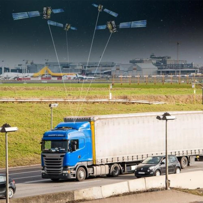
EUSPA indicates applications beyond environmental monitoring. Artificial intelligence is used for interpreting images and satellite data in agriculture, infrastructure, and disaster management, and the combination of Earth observation and positioning data can be used for transport and maritime activities.
In ports, Earth observation images can be combined with positioning through global satellite navigation systems, tracking ships, and automatic data analysis. The goal is to obtain a more complete operational picture of movements and activities in the area.
Drone services represent another area where satellite positioning can be combined with automated processing. Navigation and positioning data provide information about where a system is located, while algorithms can simultaneously interpret images and other collected data.
The use of AI does not change the origin of Copernicus data. Satellites and sensors continue to take measurements, and computer models are subsequently used for classification, change detection, forecasting, or combining observations with other sources.
Copernicus is the European Union's Earth observation program. Its data is used in services related to the atmosphere, marine environment, land surface, climate change, security, and emergency management.
EUSPA manages components of the European space program and supports the development of applications that use Copernicus, Galileo, and EGNOS. The convergence of these services and artificial intelligence expands the types of products that can be developed from spatial data, but performance and maturity must be evaluated separately for each project.

Latest News
13:52
13:45
13:35
13:34
13:27
See more news
NEWS ON THE SAME TOPICS

.webp)




.webp)